Marine Spatial Planning
Marine Spatial Planning
Concept
Marine spatial planning(MSP) aims to build a system enabling planned use of marine space by determining desirable marine uses for a better management through scientific spatial analysis and participation of interested parties
Background
MSP is introduced for constructing a ‘pre-planning and post-use’ system based on the characteristics of marine space and values of the ecosystem, preventing reckless uses of marine space.*
- The UNESCO IOC released a Road Map to manage one-third of all oceans in the world through MSP by 2025 (March 2017). About 70 countries introduced MSP into their national ocean management system.
Structure
- ROK legislated the "Marine Spatial Planning and Management Act" in April 2018 to build a MSP system for managing its jurisdictional seas.
- Marine Spatial Management Plan aims to designate and Marine Use Zones for zone-based managements by evaluating spatial characteristics through a Marine Spatial Assessment and gathering opinions from the field and considering the demands for marine use and conservation.
(Marine Use Zones) Nine Marine Use Zones* are to be decided by the results from Marine Spatial Assessment and qualified evaluation upon s patial characteristics deriving from relevant legal and institutional settings and demands for marine use, development, or conservation.
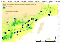
Volume of fish catch
Fish farm (fishing license)
VPASS fishing density analysis (fishing vessel location)
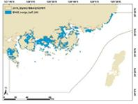
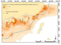
<Marine Spatial Assessment>
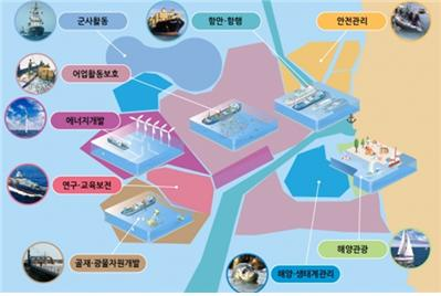
- Fishery activity protection zones
- Aggregate and mineral resource development zones
- Energy development zones
- Marine tourism zones
- Environment and ecosystem management zones
- Research and education conservation zones
- Port and navigation zones
- Military action zones
- Safety management zones
<Marine Use Zones>
- (Marine Spatial Suitability Review) The review process is to evaluate whether marine use or development plans are suitable to the purpose of each Marine Use Zone detailed by Marine Spatial Management Plans.
- More than 200 review process are conducted in 2020.
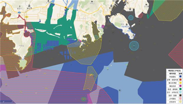
<Marine Use Zones – extract from Marine Spatial Management Plan for Busan (February 2020)>